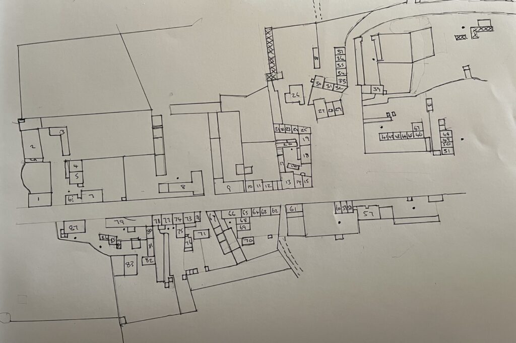
Maps are one of the most useful sources I use to study Littlethorpe history. They tell you pretty accurately what existed where and when, and in the case of the tithe map of 1853, who owned, and who occupied properties and land. The earliest detailed map available is the 1886 Ordnance Survey map published in 1888, I have have a map key to go with this to try identify what was still there when i knew the village in 1950’s, and what has disappeared.
It is interesting to see the progress from the1886 map which shows the nucleous of the established village then, and the expansion along the Cosby and Warwick Roads made through the early to mid 20th century.
All of the Ordnance Survey maps used have come from The National Library of Scotland, a brilliant archive where they are freely available.
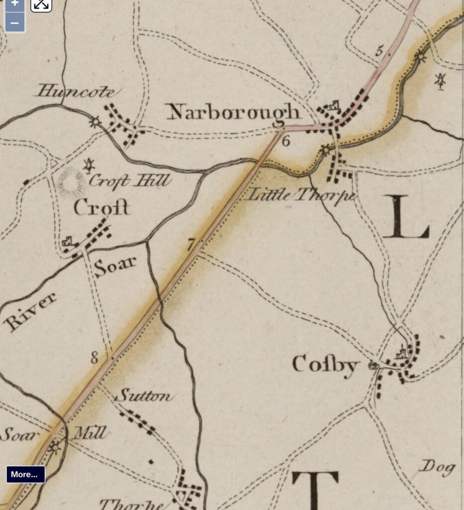
The earliest map of Littlethorpe I have found to date is the John Prior map of 1777. Not a lot of detail but it gives an idea of Littlethorpes size then compared to the surrounding villages.
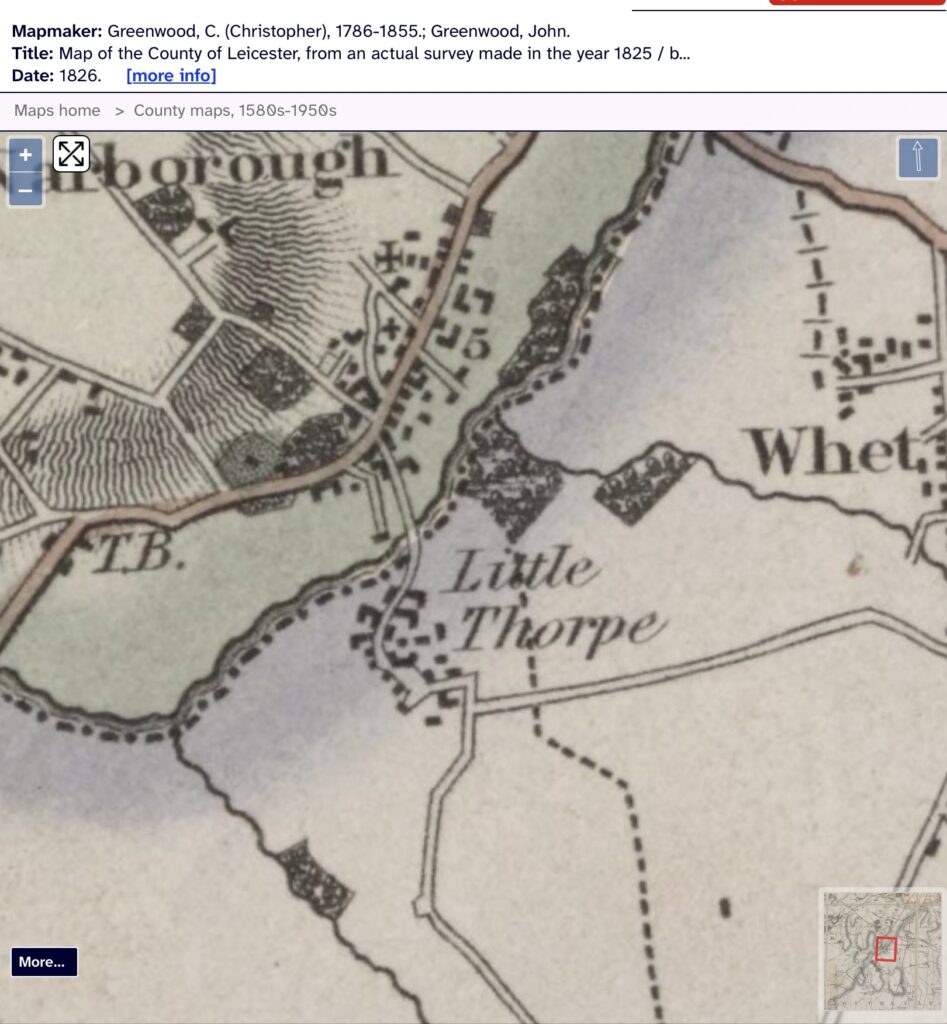
The John Greenwod map of 1826 showing some expansion in the village from 1777.
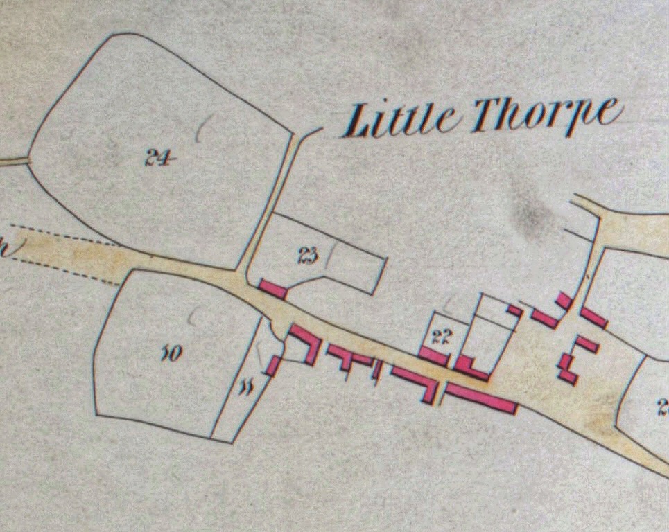
The tithe apportionment map of 1853. It doesn’t necessarily show all of the village properties i.e. Littlethorpe House we know was built in 1761 but doesn’t appear. The tithe commissioners were primarily concerned with those properties previously subject to paying 10% of their produce to the church, after this date the tithe payment was replaced by rent. Looking up the plot numbers tells us who owned, and who occupied those plots in 1853.
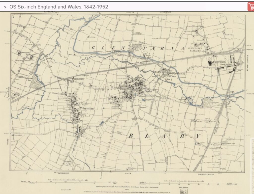
1885 Ordnance Survey map showing Whetstone and the Warwick Road fields.
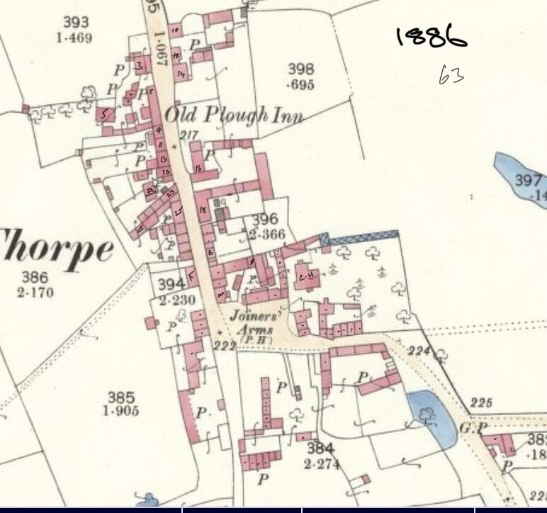
The Ordnance Survey map of 1886 published in 1888. The earliest detailed map available. Below is my map key numbering the plots.
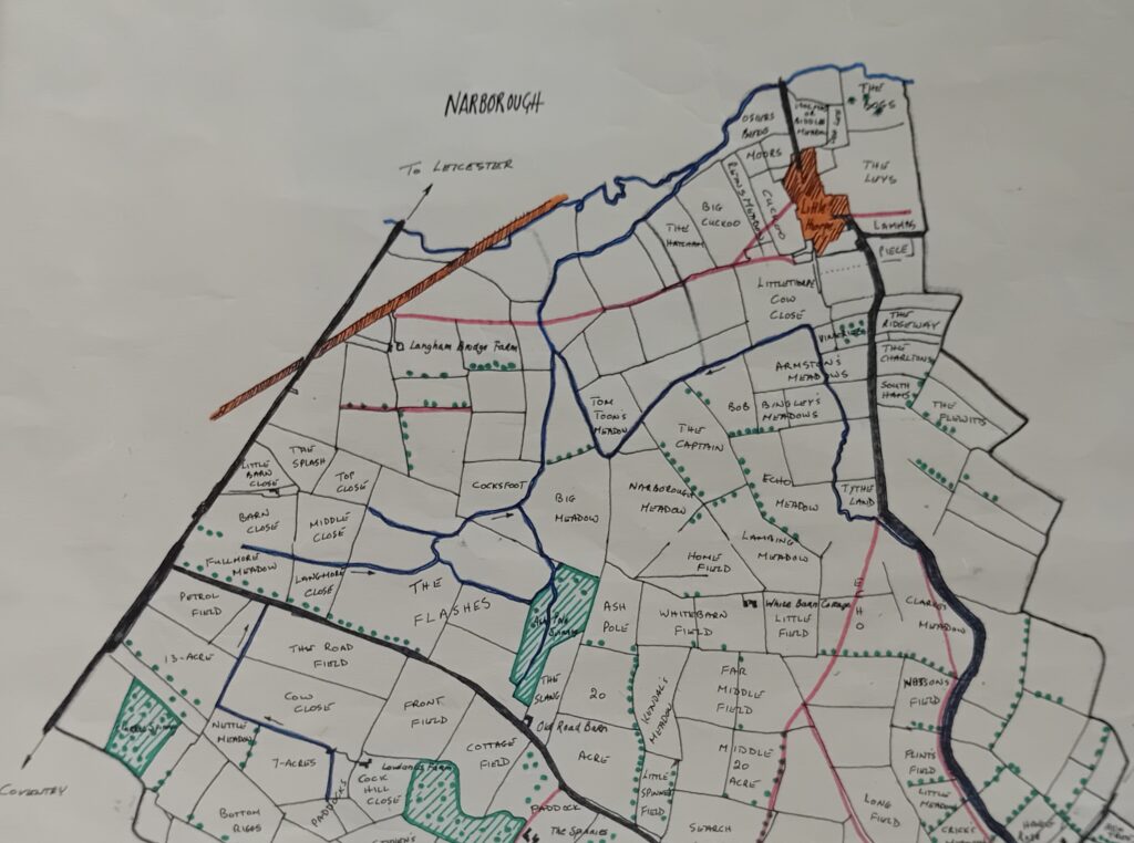
Map of field names drawn up by the local Womens Institute during their research into field names in 1972. The map was supplied by Arthur Strang of Cosby., the names were the oldest he could trace, the sources being local knowledge, farm sale catalogues, farmers deeds and local archives.
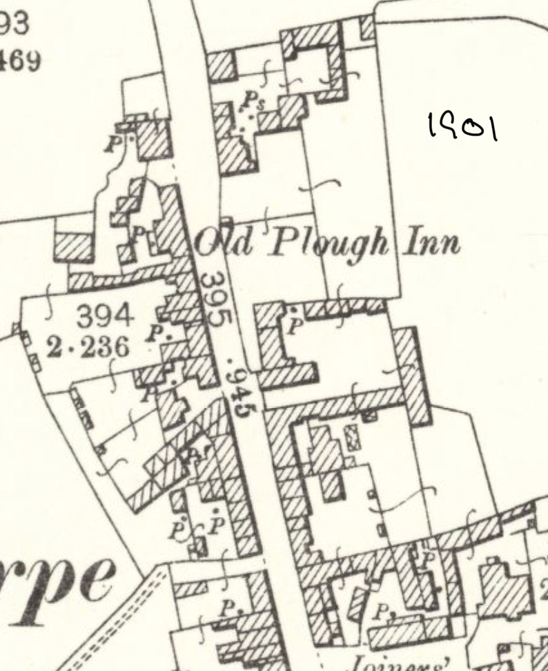
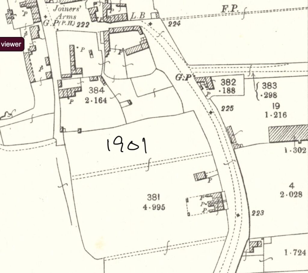
1901 Ordnance Survey maps showing Station Road and Cosby Road.
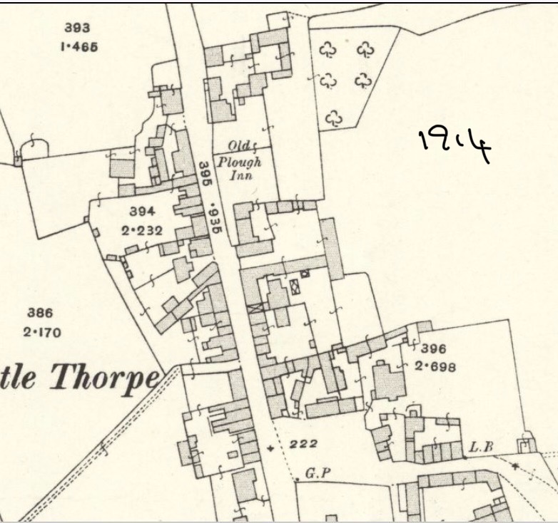
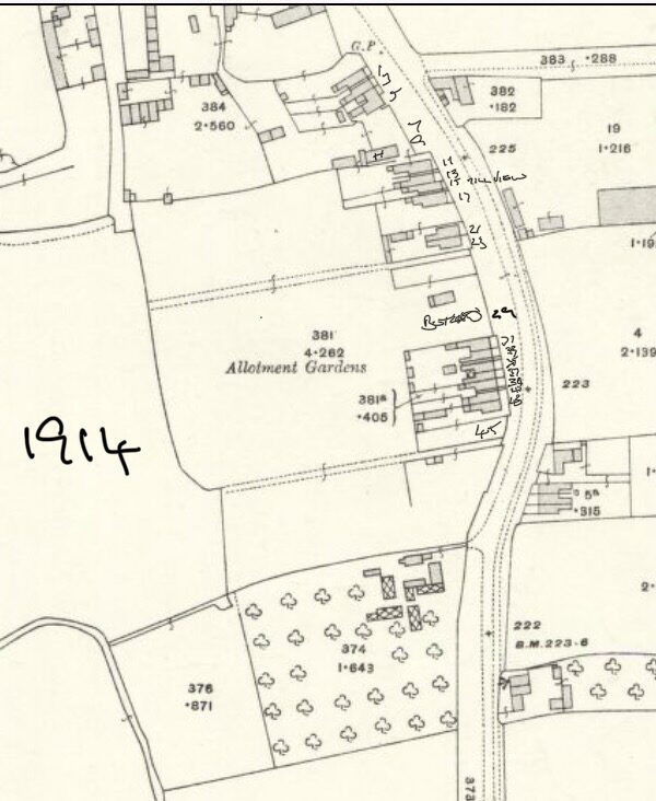
1914 Ordnance Survey maps of Station Road and Cosby Road.
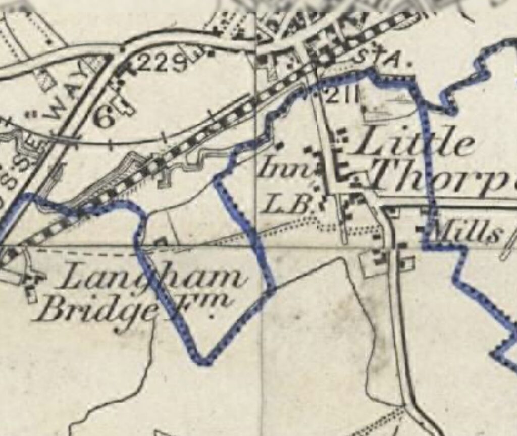
1921 Ordnance Survey map showing the Cosby parish boundary (in blue) for the census of that year.
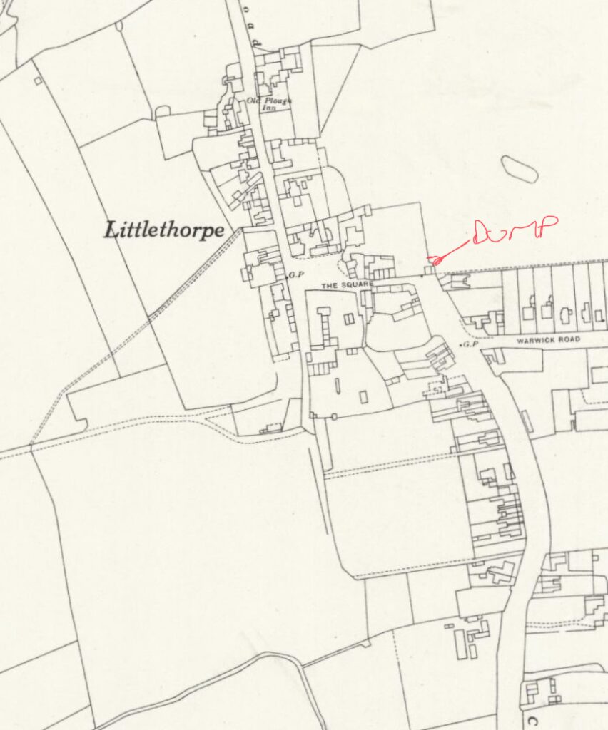
1938 Ordnance Survey map showing the location of the old village tip.
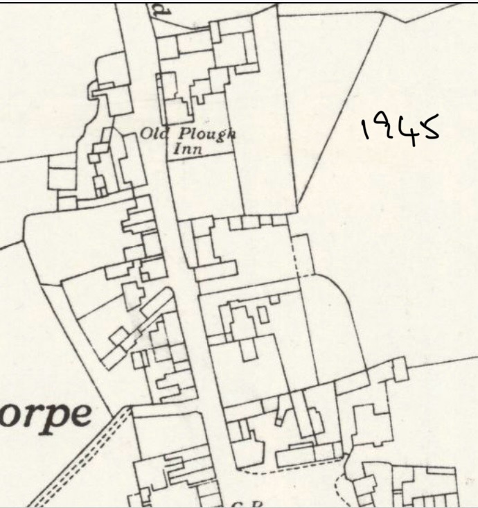
1945 Ordnance Survey map of Station Road and The Square.
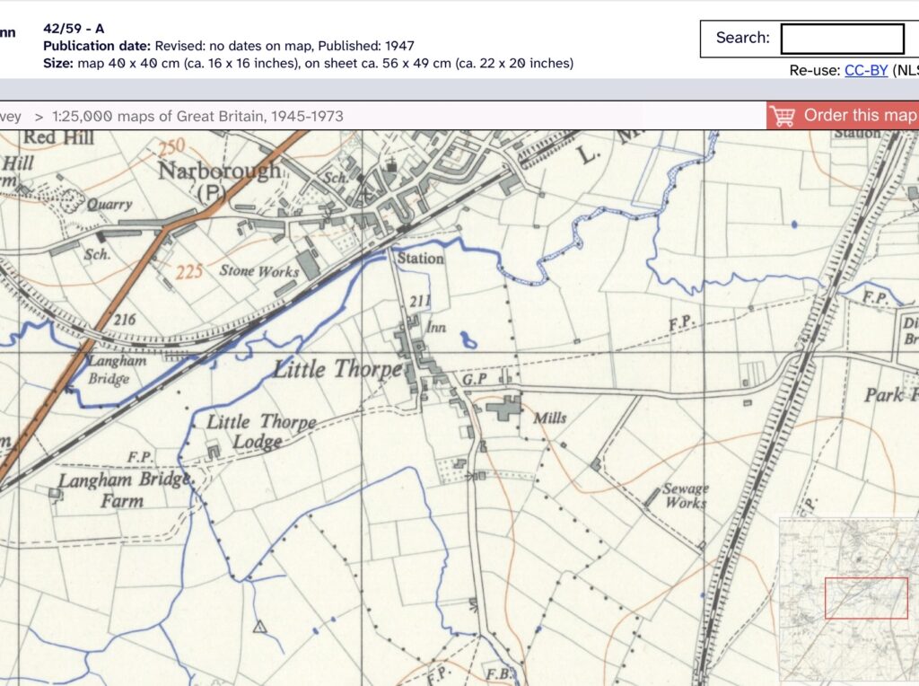
1947 Ordnance Survey map.
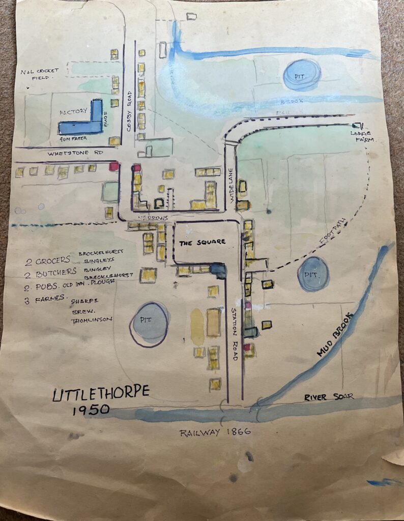
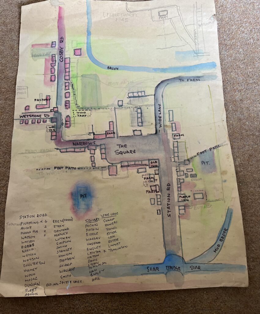
1950 the village as drawn by Nev Duncan
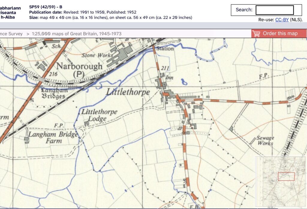
1952 Ordnance Survey map.
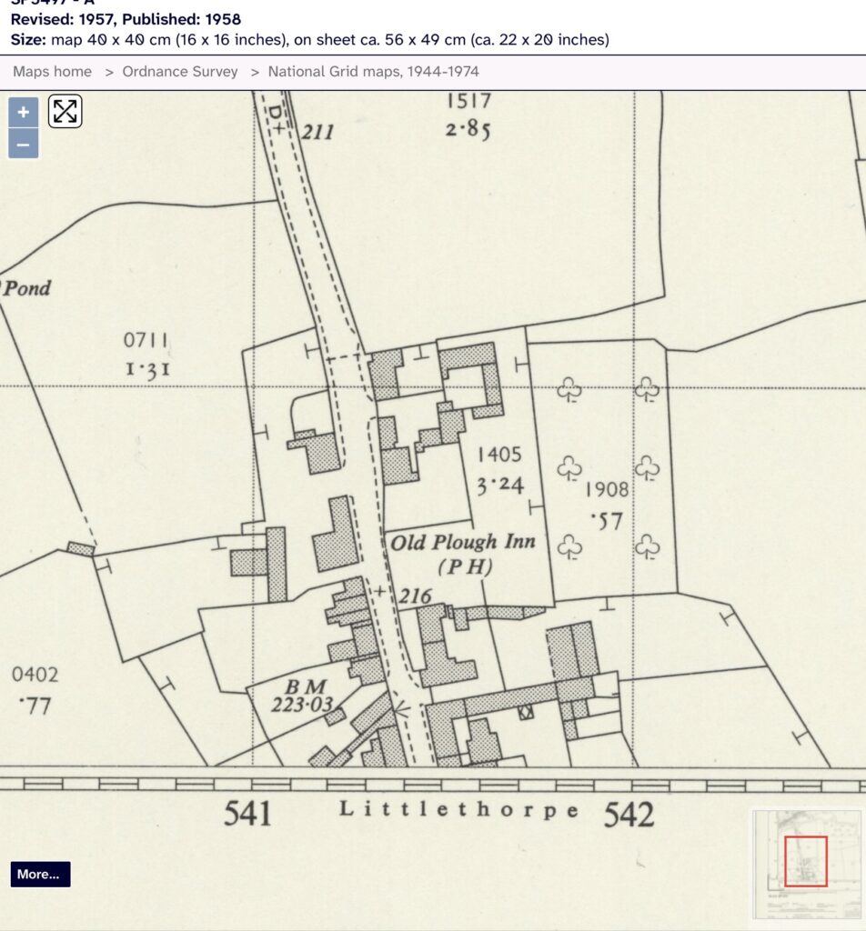
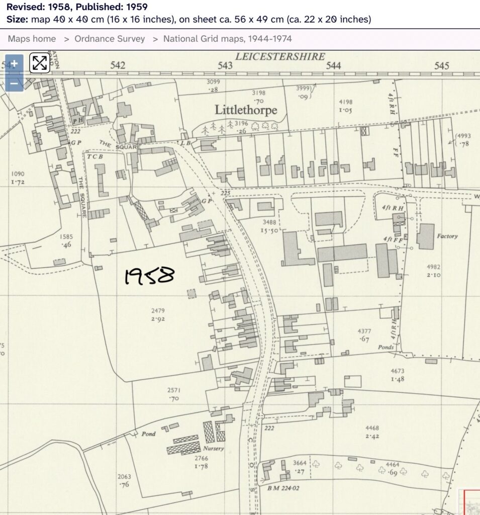
1958 Ordnance Survey map of Station Road and Cosby Roads.
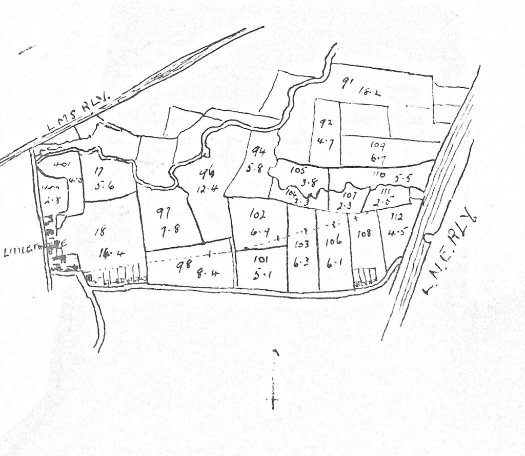
C.1960‘s Map of Littlethorpe House Farm fields. Courtesy of Stephen Durrance.
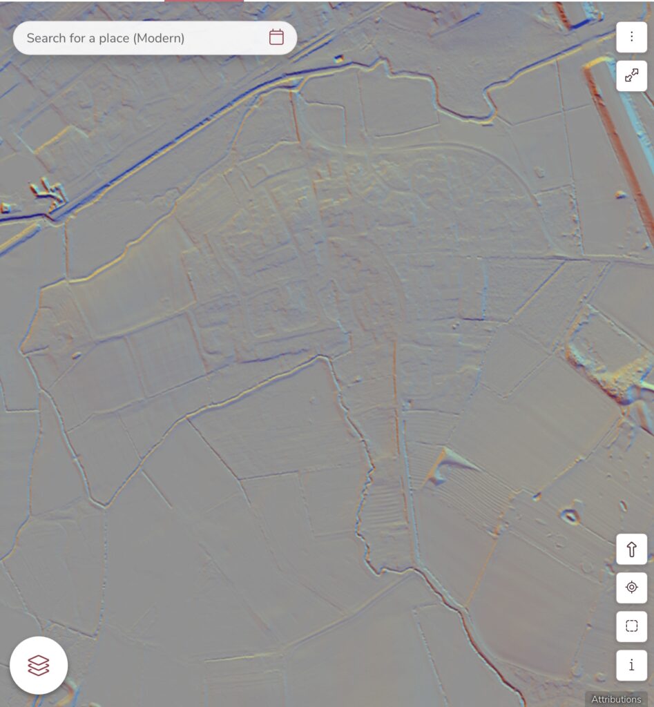
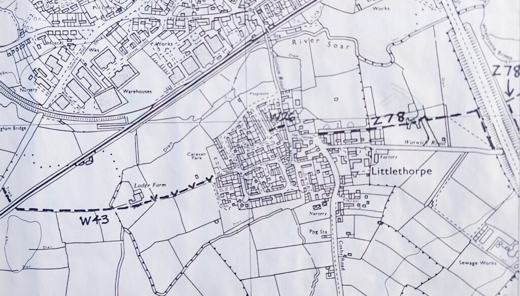
1982 map sowing re-aligned footpath route.
Sources: National Library of Scotland, Narborough & Littlethorpe W.I., Leicestershire Records Office, Nev Duncan, Stephen Durrance, Dave Thompson, Steve Charlish,
If you have, or know of any other pre-1960 maps please get in touch via the contact frorm.